Abstract

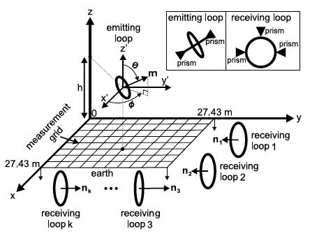
Two-dimensional (2-D) measurements of the magnetoquasistatic fields generated from a magnetic dipole (an electrically small current loop) located above the earth are compared to calculations using complex image theory. The magnetoquasistatic coupling between a vertical (i.e., surface normal parallel to the earth) emitting loop and seven vertical receiving loops was measured in a two-dimensional x-y grid of 27.43 m by 27.43 m, all above the earth, where the receiving loops were located outside this grid. Inverting the theoretical expressions to estimate two-dimensional position from measured fi eld values resulted in an average geometric position error of 1.08 m (100th percentile of the measured grid), and an average error of 0.89 m for 95th percentile of measured grid.
Copyright Notice
The documents contained in these directories are included by the contributing authors as a means to ensure timely dissemination of scholarly and technical work on a non-commercial basis. Copyright and all rights therein are maintained by the authors or by other copyright holders, notwithstanding that they have offered their works here electronically. It is understood that all persons copying this information will adhere to the terms and constraints invoked by each author’s copyright. These works may not be reposted without the explicit permission of the copyright holder.